By Dr. Andrew Feng, Associate Director, Geospatial Terrain Research and Dr. Meida Chen, Research Scientist
The advent of cutting-edge technologies such as unmanned aerial vehicles (UAVs) and advanced photogrammetry methods has dramatically transformed 3D data generation and utilization.
From synthetic datasets for urban modeling to high-fidelity radiance field reconstructions, recent research emphasizes the growing importance of efficient and precise 3D modeling for diverse applications.
In this article we explore three critical advancements: synthetic dataset creation, ground material segmentation, and enhanced radiance field modeling.
Synthetic Datasets for Realistic 3D Modeling
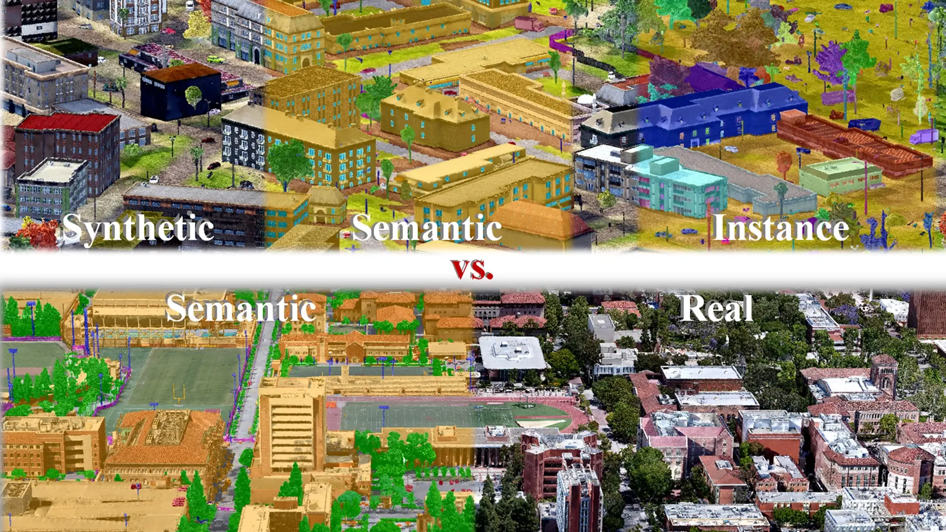
STPLS3D, a synthetic and real aerial photogrammetry 3D point cloud dataset, marks a significant milestone in procedural data generation. Designed to overcome challenges in dataset collection and annotation, STPLS3D leverages open geospatial data and commercial photogrammetry tools to produce realistic, richly annotated 3D point clouds.
Unlike datasets generated in gaming environments, STPLS3D mimics real-world survey patterns, resulting in high-quality data with balanced class distributions. By integrating synthetic and real environments, this dataset enhances the training of deep neural networks for semantic understanding and urban modeling.
Our 3D semantic segmentation model was trained using the STPLS3D dataset, and showed better results compared to other models trained on other existing datasets (more detail here).
Hybrid Approaches to Ground Material Segmentation
In the domain of semantic information extraction, the 2D-3D hybrid approach for ground material segmentation addresses the limitations of traditional photogrammetric methods.
Combining 2D texture data and 3D geometric features, this approach improves segmentation accuracy for terrain classification. By adapting the 3DMV neural network architecture to outdoor environments, at ICT, in the 3D Geospatial Terrain Lab, we have achieved precise material categorization, overcoming challenges such as inconsistent textures and low geometric resolution. This innovation not only enhances simulation fidelity for applications like virtual training but also demonstrates the value of integrated data sources.
At ICT, we are using the segmented ground material to achieve better vehicle driving simulations, including plotting efficient computing of the shortest path, taking into account different ground materials and driveability.
High-Fidelity Radiance Field Modeling with AtomGS
Further pushing the boundaries of 3D modeling, AtomGS introduces an innovative methodology to refine Gaussian splatting for radiance field reconstruction. Traditional 3D Gaussian Splatting often struggles with noisy geometry and suboptimal rendering.
In our Lab we use AtomGS to address these issues by introducing “Atomized Proliferation” and “Edge-Aware Normal Loss,” which prioritize geometric precision and rendering quality. These advancements enable precise alignment with natural geometry, enhancing both visual fidelity and computational efficiency.
AtomGS proves particularly valuable for applications demanding detailed 3D reconstructions, such as VR, digital twins, and high-resolution mapping.
We’ve been using AtomGS to reconstruct better 3D terrain for visualization. For more information, check out our project page, GitHub Repo and paper.
Implications and Future Directions
These advancements underscore a shift toward integrated methodologies that leverage synthetic data, hybrid modeling techniques, and novel optimization strategies. By addressing long-standing challenges such as data imbalance, annotation costs, and geometry optimization, these innovations lay the groundwork for next-generation 3D applications in urban planning, gaming, simulation, and beyond.
Future research is poised to explore further convergence between synthetic and real-world datasets, along with adaptive modeling techniques to tackle increasingly complex environments.
The research will also be expanded in support for Army and STTC’s new initiatives such as Incremental Dynamic Update (IDU), which aims to develop capabilities for detecting and integrating new changes from a new collection from an 3D terrain model that has already been collected and reconstructed properly. This ensures accurate and adaptive terrain reconstruction for the need of rapid terrain creation from various data sources and for different operational use cases.
While there are existing methods for UAV-based terrain collections and reconstructions, updating 3D terrains are often resource-intensive and inflexible. The IDU framework will allow for efficient updates, making it possible to integrate new data into existing models dynamically.
At ICT’s Geospatial Terrain Research Lab, we will further research in this field to support relevant IDU tasks and technical gaps from 2025 moving forward.
AUTHOR BIOS:
Dr. Andrew Feng is the Associate Director and Research Lead for ICT’s Geospatial Terrain Research Lab. Dr. Feng holds a PhD and MS in Computer Science from the University of Illinois at Urbana-Champaign. He joined ICT in 2011 as a Research Programmer specializing in computer graphics, then as a Research Associate focusing on 3D avatar generation and motion synthesis, before becoming a Research Computer Scientist within the Geospatial Terrain Research group.
Dr. Meida Chen is a Research Scientist and Co-Lead for ICT’s 3D Geospatial Research, focusing on 3D computer vision and synthetic training data generation. Dr. Meida Chen received his PhD. from the Department of Civil and Environmental Engineering, University of Southern California in 2020, following his MS, Computer Science and MCM, Construction Management (Civil Engineering), also from USC. He joined USC Institute for Creative Technologies as a Research Assistant in 2017, and received two promotions: Research Associate (2020), then Senior Research Associate (2022). Alongside his role as a Research Scientist at ICT, Dr. Chen is also a lecturer at the Department of Civil and Environmental Engineering, Viterbi School of Engineering, on the Introduction to Civil Engineering Graphics course.
//
